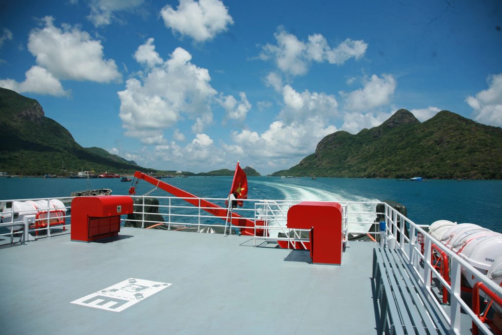

Phu Quy is an island district in Binh Thuan province, at the coordinates of 105o55’ to 108o58’ East l ngitude and 10o29’ to 10o33’ North latitude. Phu Quy is about 56 nautical miles (more than 100 km) from Phan Thiet to the Southeast, 540 km Southwest of the Spratly Islands and about 725 km from Paracel Islands. Phu Quy is about 150 km South of Cam Ranh, 120 km East of Vung Tau and 333 km Northeast of Con Son.
The area of Phu Quy Island including odd islands is 32 km2. The main island of Phu Quy is 17.92km2 wide, shaped like a deflecting rectangular, 7km in length, and 4.5km in width of the widest place. Phu Quy is the chokepoint geographic region in the east of Binh Thuan province, Phu Quy is a near locality and an outward island, a rear of the Spratly Islands.
Around Phu Quy, there are many large and small islands forming an archipelago, local people call them “odd islands”. In addition to the main island, the other ones are divided into two zones, ranging from 27 to 35 nautical miles.
The first area has 6 odd islands, including: Hon Trung, Hon Den, Hon Do, Hon Giua, Hon Trao and Hon Chieng. Hon Trung is a place where swarms of terns used to gather to reproduce. This island is about 9km northwest of the main island and it becomes an anchor point for many types of boats.
In the South monsoon season, there are a roadstead in the north, and in the north monsoon season, there are a roadstead in the south.
In the North of Phu Quy Island, about 200 to 300 m from the shore, there are 3 odd islands such as Hon Den, Hon Giua and Hon Do. Hon Giua is a row of rocks lying horizontally as a span connecting Hon Den with Hon Do. Hon Den consists of all black rocks known as Hon Ngoai, Hon Nghien or Hon Muc.
These three islands are called by many other names such as Hon Trong, Hon But, Hon Son, Hon But Nghien… There are Hon Trao and Hon Chieng in the Southeast.
Hon Trao (or Hon Trieu) often has big waves overflowing, tide also means waves. Hon Chieng is a block of rock shaped like a gong.
The second area has 4 odd islands, including: Hon Hai, Hon Do Lon, Hon Do Nho and Hon Ty.
Hon Hai (also known as Hon Kham) is like a sharp square stone, rising straight from the sea like an altar, more than 100m high, 65km southwest of the main island. Hon Hai is a point A6 as the baseline for calculating Vietnam’s territorial sea, is also the farthest point of the Vietnam internal water border in the southeast of South China Sea with the coordinates of 9o58’ North latitude, 109o5′ East longitude.
Hon Do Lon (also known as Hon Bo) is 60m high, 21km west of Hon Hai, 50km south of the big island. In the past, annually every April and May of the lunar calendar, sea birds nest and reproduce in Hon Do, islanders often take bird eggs to use.
Hon Ty (or Hon Vung) is about 5km west of Hon Hai. Hon Ty is shaped like a lid of a clay pot formerly, so islanders often call it Hon Vung. According to the ancient people, in the past, people discovered a lot of zinc coins here, so this island is also known as Hon Tien.
Hon Do Nho (or Hon Trao) is about 3km east of Hon Do Lon, consisting of many jagged rock rapids, emerging when the water is low (shallow), only undulating on the sea surface when the water is high.
Hon Tro (also known as Hon Moi) is a new island formed in 1923 due to volcanic eruptions in the sea. The volcanic vibration and eruption lasted for nearly a month in the southwestern area of the main island to form a new island rising out of the water about 20m and about 60km from the shore. This island is circular with a diameter of about 40m, on the surface is white sand and surrounded by gentle terraced stone edges.
After 3 months from the date of that phenomenon, this island sunk 33m from the water surface and formed a reef 700m long, nearly 500m wide, Phu Quy people called it Ran Moi.
The largest of the odd islands in Phu Quy is Hon Tranh, about 1.5km southeast of the main island. Hon Tranh is shaped like the letter S, an area of 2.8 km2, the widest place is 400 meters and the longest is 1,200 m. Previously, this island was a deserted island with overgrown grass, so it was called Hon Tranh.
In addition to the odd islands, Phu Quy also has many promontories, creeks, capes, and beaches such as Da Du Bay (Lach Du), Thue Bay, Ky Phu Bay, Dat Can Bay in the East; Lang Beach, Cha Tre Bay, Ong Co Bay in the West, Ong Luong Bay, Chua Bay (Lach Chua), Cay Choi Bay (Lach Choi), Nui Beach, Nho Beach, Da Do Beach in the South and the other promontories, creeks such as: Dua Promontory, Ong Tinh Promontory, Thay Promontory, Ong Ben Creek, Cay The Cape, Ganh Hang Cape, Trau Nam Cape, Phu Beach…
Phu Quy Island through ancient history has many names such as: Co Long (Koh Rong), Cu Lao Khoai Xu, Thuan Tinh Island, Chin Lang Island, Hon Lon, Phu Quy, Cu Lao Thu, Poulo Cecir de Mer and the name commonly of local people is Hon…
Talking about the name Co Long (Koh Rong), many documents show that in August 1783, when being pursued by the Tay Son army, Nguyen Anh had to flee from Gia Dinh to Co Cot Co Long island, and return to Phu Quoc. The Tay Son army besieged but at that time there was a storm, so after 7 days and nights floating on the sea, Nguyen Anh escaped and ran to Tho Chu island where is quite far from the mainland. This legend is associated with some existing monuments in Binh Thuan and on the island such as: Buu Son Pagoda in Phu Hai, Van Thach Long in Mui Ne (Phan Thiet), Linh Quang Pagoda and Gia Long Well (King Well) inHon Tranh (Phu Quy)…
Regarding the name of Cu Lao Khoai, it is said that a group of fishermen in other provinces on the way to practice flying fish net discovered this island. When they left the island, they accidentally left the stumps of sweet potatoes. The next time they came back to the island, they saw that stumps had taken root and grown well, giving big and delicious sweet potatoes, so they called this island the land of Cu Lao Khoai.
The name Cu Lao Thu comes from the shape of the island like a mackerel. Some people believe that this place was a fishing ground with a lot of mackerel in the past, so fishermen used to call it Hon Thu. Cu Lao Thu was a popular name in later times. Phu Quy residents used to call their island Hon for short, rustic, simple as the human character on the island.
The name Thuan Tinh island is officially mentioned in the document under the first Thieu Tri era (1841) when talking about Phu Quy. Thuan Tinh Island at that time belonged to Phu Quy district, Tuy Phong district, Ninh Thuan palace. By the 4th Thieu Tri era (1844), the island was renamed from Ha district to Phu Quy district directly under Tuy Phong district, Ninh Thuan district, Binh Thuan province.
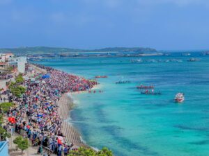
Rich in tourism potential, Phu Quy is blessed by nature with not only resources, beauty spots with beaches, coral reefs, clusters of black rocks, colorful rocks undulating in the sea and fresh cool climate all year round; but on the island there are also many unique historical, cultural relics, artistic architecture. Besides, Phu Quy people are industrious, naive and hospitable. Traveling to Phu Quy, visitors will be satisfied with pastimes such as swimming, yachting, fishing, climbing, and collecting marine species…
Phu Quy has long been famous for its rare speciality seafood. In 1935, traders in Phan Thiet, Central and Southern provinces went to Phu Quy by boat to buy dried fish, lobster, snails… to sell to Cao Mien. Since the 1990s of the 20th century, with the efforts of the authorities, the local people and the strong support of the province and the Central, Phu Quy has really changed. Fishing with effective means of fishing has increased people’s income. In addition to the development of the seafood industry, which is considered a key economy, Phu Quy is also known as an archipelago with great potential for marine ecotourism development. Visitors to Phu Quy island will be welcomed by the dawn on the sea, the beautiful scenery here has fascinated and satisfied many visitors and is also a place of inspiration for poetry.
On the island there are many beauty spots and historical relics containing unique cultural and architectural values such as Linh Quang pagoda, An Thanh temple with a lifespan of over 200 years. In October 1941, a large “Grandfather” fish drifted on the island; according to research documents of the Binh Thuan Provincial Museum, this is the first whale drifting on the island and is solemnly buried by the people according to the customs of the fishermen on the island, thereof the people of Trieu Duong take the date October 15th of the lunar calendar every year is the death anniversary of “Grandfather” and is called “Great grandfather” death anniversary. In addition to the main object of worship is “Grandfather” fish. In An Thanh temple, we also worship Thanh Hoang, Tien Hien and Hau Hien of the village like some village hall in the mainland. Associated with the function of worshiping and performing whale-related rituals, so many sets of “Grandfather” fish bones that drifted on the island are kept in An Thanh temple, including a very large skeleton showing when he was alive, this “Grandfather” fish can be over 20m long. With its typical historical and cultural values, An Thanh temple was made a decision and issued a Degree of national historical relics ranking in 1996 by the Ministry of Culture and Information (now the Ministry of Culture, Sports and Tourism).
The attraction of Phu Quy’s tourism potential must also include the landscape of the hills and surrounding small islands. Cam mountain is 4km west of the port, is 108m high above sea level, on the top of the mountain there is a lighthouse of the largest type in Vietnam. At night, the lighthouse orients fishermen’s boats in the sea to go right direction, connecting the home island with the dear motherland. About 4km east of Cam mountain is Cao Cat mountain where there is Linh Son pagoda on the top of the mountain, from here you can see the vast sea of the country.
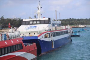
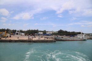
With such potential and advantages, in recent years, Phu Quy district is very interested in exploiting and promoting tourism on the island. Immediately, Phu Quy is concentrating on all the conditions of tourism infrastructure such as upgrading and completing the transport system to tourist destinations; developing ships, airports, docks, hotel and restaurant systems, creating diversified and attractive tourism products… with the most common goal to make Phu Quy a special tourism and service economic zones.
Phu Quy – an offshore island district, is a place with great potentials for marine economic development and ecotourism.
Hopefully in the coming time, there will be more ecotourism tours from all parts of the country to Phu Quy and more and more people will know Phu Quy, an island in the middle of the poetic, pristine and beautiful sea and many places have never had human footprints.