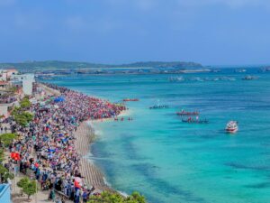
Bình Thuận province has 10 administrative units, among which Phú Quý is a small, remote island district — a vast sea area with rolling waves, home to famous scenic spots, green coconut trees reflecting in the water, and long stretches of white sand harmonizing with the magnificent and poetic natural landscape of our beloved country.
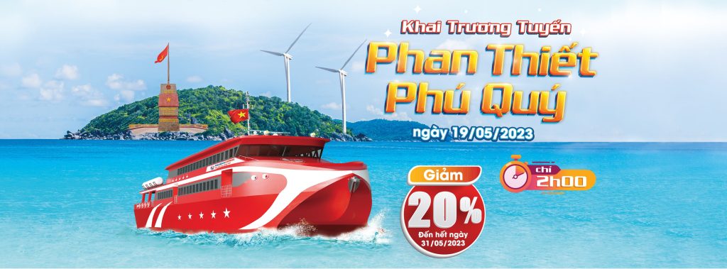
Located 56.7 nautical miles (about 105 km) east-southeast from the coast of Phan Thiết city, you will find an island in the East Sea with a very fascinating shape. According to the imagination and observations of many people, when viewed from the east, Phú Quý Island resembles a dragon curling and rising on the blue sea (the dragon’s shape corresponds to several place names on the island: the head — Long Hải, the body — Tam Thanh, the tail — Ngũ Phụng). From the north, it looks like a mackerel fish, and when viewed from the southwest, it resembles a giant whale surfacing, with Cao Cát mountain as the head and Ông Đụn mountain as the tail. From the Thầy promontory (Long Hải) looking towards Cao Cát mountain, one can see a dragon’s jaw holding a pearl. Phú Quý is an archipelago, surrounded by 10 large and small islets located 1 to 100 km from the main island, locally known as “hòn lẻ” (small islets). Based on their shapes, locations, colors, and formation legends, each islet has a memorable name, such as: Big Hòn Trứng, Hòn Đen, Hòn Đỏ, Hòn Giữa, Hòn Hải, Big Hòn Đồ, Hòn Tý, Small Hòn Đồ. In addition, there is a small island newly formed in 1923 called Hòn Tro. The largest islet among the archipelago is Hòn Tranh, shaped like a miniature “S” of Vietnam, just 0.5 nautical miles from the main island. Although located offshore, Hòn Tranh is sheltered by mountains forming a solid wave barrier, so the waters around it are calm year-round, and it is associated with many legends and the faith of local fishermen.
The main island of Phú Quý, home to the vast majority of the island’s population, has an irregular rectangular shape with a modest area of about 16.4 km², consisting of hills, mountains, and flat lands. The harsh climate — influenced by a monsoon regime with two distinct seasons: the south wind season from May to August, and the north wind season from September to April of the following year — along with strong winds, relatively high average temperatures, poor soil, water scarcity, and primitive farming techniques mainly relying on human labor and rainwater, makes the work of the people even more arduous and demanding. These natural factors require the inhabitants to find a positive way of life and adapt flexibly to the natural environment. These conditions have significantly influenced both the material and spiritual lives of the people here, contributing to a distinctive, creative island folklore literature that meets the entertainment needs and expresses the emotions of the hardworking masses.
The formation and development process of Phú Quý Island has undergone several changes in administrative units and levels of governance. The island’s origins are recorded in history dating back to the Early Lê dynasty (981–1009). The ancient historical book Đại Nam Nhất Thống Chí records: “Thuận Tịnh Island: in the East Sea suddenly arose an island directly facing the coast of Phan Lý. The island is 15 miles long, surrounded by sandy beaches on all sides. The inhabitants, governed by local chiefs, live in 11 villages and must pay yearly tribute of cloth.”
Archaeological materials from prehistoric and early historic times, researched by a scientific group studying the relics on Phú Quý Island, show that people have lived here since ancient times. Archaeologists have discovered many ancient cultural relics (across all three communes on the island): in ancient graves concentrated in Long Hải commune, many artifacts such as pottery shards—tools used by early people—and stone axes have been found.
Additionally, there are artifacts related to traditional occupations such as weaving, peanut processing, and betel lime containers. During quarrying activities, locals found large urn tombs containing labor tools like hammers and intricately crafted stone bracelets. Based on historical documents and physical evidence such as axes, bone tools, and urn tombs, combined with archaeological investigations over the past 20 years by Bình Thuận Museum and later the Vietnam Institute of Archaeology, it has been confirmed that the prehistoric and early historic archaeological sites on Phú Quý Island are typical of the late Sa Huỳnh culture transitioning to the proto-Champa culture — a cultural foundation existing 2,500 to 3,000 years ago. According to archaeologists Professors Trần Quốc Vượng and Hà Văn Tấn: “The Sa Huỳnh culture bearers are the direct ancestors of the people who built the Champa states.”
Therefore, from early on, the Cham people created a rich and brilliant culture alongside a developed and prosperous socio-economic life. This was a flourishing ancient culture in the South Central Coast region. This aligns with folklore suggesting that before human settlers from the mainland arrived, the island was inhabited by people living by gathering and coastal fishing. However, how this culture existed and developed, and how its people lived and worked, remain open questions without definite answers.
Historically, the island has had many names: Koh-rong (the Cham name), later called Cổ Long, Thuận Tịnh, Cù Lao Khoai, Cù Lao Thu, Nine Villages Island, and Phú Quý (Poulo Cecir de mer). The name Cù Lao Khoai is said to have originated when a group of fishermen from northern Vietnam, traveling for net fishing, landed on the island and left behind some tubers planted in the soil. Upon returning, they found the tubers had sprouted into large sweet potatoes and thus named the island “Khoai xứ” (Sweet Potato Land). The name Nine Villages Island comes from nine groups of fishermen from Central Vietnam who settled here, naming their villages after their hometowns, such as Mỹ Khê village (from Mỹ Khê commune, Nghĩa Hành district), An Hòa village (An Hòa commune, Bình Sơn district, Quảng Ngãi province), Mỹ Xuyên village (Mỹ Xuyên commune, Quảng Nam province), Phú Ninh village (Phú Ninh commune, Quảng Bình province), and others. The name Cù Lao Thu derives from the island’s shape resembling a mackerel fish, although some say it was named for its abundant mackerel fishing grounds. During the early Nguyễn dynasty, the island was called Tổng Hạ, belonging to Tuy Phong district, Bình Thuận province. From the 4th year of the Thiệu Trị reign (1844), due to its rich economic potential and abundant special products taxed by the Huế court, the island was renamed Tổng Phú Quý under Bình Thuận province, Ninh Thuận prefecture, Tuy Phong district. On December 15, 1977, recognizing the island’s important geographical position, Phú Quý commune was upgraded to Phú Quý district under Bình Thuận province.